24 hours of flights around Sydney
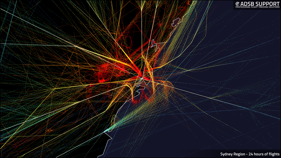
This is a snapshot of 24 hours of flights captured around the Sydney region from our ADS-B ground station network. The colour-coding is based on altitude, so red is lower, and that's why you see a lot of red as flights converge on the approach paths around the airport(s).
We don't have great ground coverage at YSSY / SYD (Sydney Airport), so you only see the approaches here, but you can see CDU (Camden) and WSI (Western Sydney) to the west, and YSRI (Richmond RAAF) to the north-west.
Some other interesting features here are the little circles in yellow - I looked a little deeper into the data for this day (18 Dec 2025). Both circles are from the same NSW Police Cessna C208, likely doing some aerial support around Liverpool and Bondi.
One other feature that notable is some of the higher altitude tracks that seem to radiate from YSSY. This is because YSSY can be used as a navigation waypoint for overflights, e.g. Auckland to Perth, Brisbane to Hobart etc.